Category Archives: Rides

AzKicker Rides

2023 National Park Tour

In August 2023 I continued my retirement goal of visiting all National Parks and all States by motorcycle. In this trip, I visited 13  National Parks I had not already visited. I visited 13 states, of which only 4 I had not previously toured by motorcycle.

Total trip length of 7467 miles was divided between 4843 miles pulling the trailer and 2624 miles of riding the bike, including a long 15-hour day in the saddle in Montana’s Glacier N.P.

Wildfires and rain interfered with some of my park visits, but not with the enjoyment of the trip. My trusty Honda Africa Twin handled the worst of it without complaint. I, on the other hand, complained vociferously, but there was nobody there to listen.

The most difficult riding was in Glacier N.P. where a combination of factors led to some slipping and sliding, but nothing the bike couldn’t handle. The first 9 miles of the road through the park had been stripped of pavement in my direction of travel, and it was raining hard with reduced visibility. My lane was mud, but the oncoming traffic still had pavement on their side so they were travelling faster. This caused them to be generating bow-waves of muddy water that were up to my waist and the top of my fuel tank. When combined with submerged potholes and low-traction mud on my side of the road I had an “interesting” ride until I got back on the pavement.

I also did some rides other than through National Parks. In New Mexico I made a pilgrimage to Madrid, the setting for the movie “Wild Hogs”, and rode to the top of Sandia Peak. In Colorado, I drove up Pike’s Peak (14,100 ft) and visited Garden of the Gods. I visited the Little Bighorn Battlefield National Monument in Montana. I even stopped in Sturgis during Bike Week… and yes, it is just like the pictures and video.

One negative incident was when I was sleeping in the trailer in a Walmart parking lot and someone in a high-top camper van ran into my 4Runner, hard enough to lift me out of the cot. They hit-and-run, but they didn’t cause major damage so I continued the trip.

I had a great time overall, got to visit with friends and family along the way, saw spectacular scenery and even had a few “riding adventures” along the way. What more could I ask for?

2022 National Park Tour

With retirement came an opportunity to take a month long tour and visit of 17 states (below) and 8 National Parks I had never before visited by motorcycle.  I left on Aug 23 and returned home Sep 15.

This is part of my long-range goal of visiting ALL of the National Parks on my motorcycle.

See the details under the Trips link above.

PCH, Idyllwild, and Big Bear — Oh My!

A buddy and I took a 5 day, 1700+ mile trip to California to ride the Pacific Coast Highway (PCH) and explore some other mountain areas in southern California. Here are the maps for those five days if you are interested:

Miles Day Summary
477 Day 1 Phoenix to Santa Monica, then PCH to Ventura
254 Day 2 Ventura to San Luis Obispo (SLO), Cayucos, Morro Bay, Montana de Oro, SLO
417 Day 3 SLO to Monterey, then back down coast to Ventura
195 Day 4 Ventura, Mulholland Highway, Big Bear vi CA-18
444 Day 5 Big Bear to Idyllwild, Hemet, Indio, Phoenix

Pacific Coast Highway (PCH)

1311_0695_b 1311_0704_f
1311_0726_b 1311_0765_a

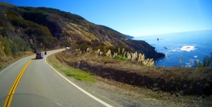
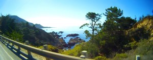
What can I say about Highway 1, the Pacific Coast Highway, that hasn’t already been said more eloquently? It is a Bucket List ride, best ridden North to South so you are on the ocean (and scenic vista pullout) side.

Mulholland Highway

For those who enjoy a challenge, or simply like to people-watch, you should check out the stretch of Mulholland Highway (known locally as “The Snake”) between Topanga Canyon Road and Kanan Road (see Day 4 map for details). There are whole websites devoted to the spectacular crashes and amazing vehicles along this road. If you want to drive it, enter from Topanga. If you just want to people-watch, come in from Kanan. You must keep an eye on your rear-view mirrors, there are crazy drivers were illegally (over the double yellow line) passing us doing 70 MPH heading into a blind curve. A weekday may be better than a weekend to drive it, but the weekend is the best time to people-watch.

CA-18 Highway from San Bernardino to Big Bear

This is another great ride with lots of twisties. There are lots of places where the road is actually hanging off the side of the mountain on cantilevered supports. As you ride up from San Bernardino you can see the underside of the road above you. Big Bear is above 8000 ft in elevation, so there is a big change in temperature, and frequent storms. It was spectacular weather for us and well worth the trip.

Idyllwild

On Day 5 we took CA-38 (a very nice ride) from Big Bear down to Redlands, to Banning, where we turned off to ride through Idyllwild. A beautiful ride up from desert to forest with big vistas. We took a side trip to Hemet, a nice ride to a mediocre destination, then turned around and went back over the mountain and down to Indio. We had dinner and waited for sunset before making the 4 hour trip home.

Conclusions

Driving across the desert in July/August is HOT and not to be undertaken lightly. We have extensive hot-weather riding experience and special cooling gear, and it was still uncomfortably warm at times. We also moved this trip by 2 days to avoid storms in the Big Bear and Idyllwild destinations. I would recommend this ride for Spring and Fall rather than Summer if you have to cross much desert. If you are starting in the LA region, it’s merely uncomfortable.

I don’t normally give Google much credit, but I have to give them credit for keeping their map application up to date. We were going to ride CA-2, the Angeles Crest Highway (one of our favorites) but Google Maps wouldn’t let us cross a certain location no matter how many waypoints I used. It turns out that there had been a mudslide across the highway and it was closed.

Yosemite Day 5

Yosemite Trip: Day 1    Day 2    Days 3-4    Day 5   

We left Yosemite yesterday afternoon and drove all the way down to Bakersfield (200+ miles) to set ourselves up for CA-2, the Angeles Crest Scenic Highway. We left Bakersfield and drove to La Canada Flintridge, where we got gas for the trip. We then started up the most beautifully paved road I have ever been on. It’s flawless pavement, light traffic, and lots of twisties with great scenery.

Angeles Crest Highway

Angeles Crest Highway

We had lunch at Newcombs Ranch Restaurant and Bar, a hangout for bikers and sports car enthusiasts.

Newcombs Ranch Restaurant and Bar

Newcombs Ranch Restaurant and Bar

There were a couple areas with rocks on the road, so caution should be exercised. When you emerge from the tunnel, more beautiful vistas await. My sports camera does not do it justice.

View from East of the tunnel

View from East of the tunnel

We spent so much time enjoying Highway 2 it was now time to get some miles on. Our goal was to make Blythe (about 200 miles) so we would have a short run home. We got there about 9pm, then decided to just push for home to get across I-10 before the sun came up. This made for a 540 mile last day ending at 1:30am. The next day we met at our favorite restaurant to celebrate a great ride.

Yosemite Day 3-4 — Yosemite National Park

Yosemite Trip: Day 1    Day 2    Days 3-4    Day 5   

Adjectives fail me… I think Yosemite is one of the most amazing places on earth.

We rode 2 hours from Fresno to catch this first glimpse of Yosemite Valley just before we went through the tunnel.

First Glimpse of Yosemite Valley

First Glimpse of Yosemite Valley

Everywhere you look, it’s AMAZING!  This video is from the meadow at the entrance. There was a crowd of people watching El Capitan climbers through telescopes and binoculars.

My nephew joined us for the ride into Yosemite, here we are standing in front of Bridal Veil Falls. Not much water this time of year, but still a beautiful place!

Bridal Veil Falls

The Crew In Front Of Bridal Veil Falls

After checking into our cabin tent and a meal, we decided to go up to Glacier Point to watch the sunset and full moon rise.

Half Dome from Glacier Point

Half Dome from Glacier Point

Sunset is spectacular, bathing the stone with first a yellow light, then a pink light. You can just barely see the moon rising in the notch to the right of Half Dome in the second picture.

yellow light on Half Dome

First comes the yellow light on Half Dome

Pimk Light

Then the pink light.

It gets very cold at 7200ft elevation when the sun goes down, so we hustled down to the valley floor to get warm. The granite cliffs are very reflective, so the bright moonlight makes you feel like you are in a black & white movie. We visited the Ansel Adams gallery and the meadow before bidding adieu to Yosemite.

Yosemite Trip was a Blast – Day 1

Yosemite Trip: Day 1    Day 2    Days 3-4    Day 5   

We did it! And it was a BLAST!!

We changed the route a little while we were underway, but we drove 1650 miles in 5 days. We spent Wednesday night in Yosemite as planned, but when we got to Blythe at 9pm on Friday night, we decided to make the 3.5 hour run for home in the cool of the night rather than wait for the following day to drive into the rising sun.

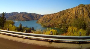
The first day was pretty brutal, we drove almost 600 miles, the first 6 hours in temperatures up to 110F.  The LD Comfort cool gear we used was fine when it was wet, but it dries out more often than we wanted to stop. We made it to San Bernadino, where we were able to escape the heat by taking a scenic route up into the mountains past Silverwood Lake.

CA-18 - Twisties

CA-18 – Twisties

Silverwood Lake

Silverwood Lake

Twisties and cooler temps… we needed that!  We finished up the day by driving to Bakersfield.

Planning For Yosemite

After our last big ride, we decided that we were up for a bigger adventure: a week-long ride through Sequoia and Yosemite National Parks in California.   About a 2000 mile ride in 6 days, so some big ride days (> 350 miles/day) and some easy ride days.

We are trying to apply some of the lessons we learned from our Grand Canyon trip. We are “camping” for 1 night in Yosemite, but it is a tent cabin that is essentially like a hotel room, including beds and linens. This gives us the ability to stay in Yosemite Valley for 2 days, but to travel light. The rest of the time we will just stay in motels.

We have planned a route that gives us some twisties every day except the last day, which is just a fast run across the desert, hopefully before it gets too hot.

We have used Google Maps to find roads that look interesting wherever possible. This also allows us to calculate mileage ranges and times. We have a spreadsheet that summarizes the route, mileage, start & stop times, weather.

Should be fun!

We recently organized our own “supported” camping trip. We left Chandler (Phoenix area) bright and early (for us) and drove to Payson, then up onto the Mogollon Rim, off the Rim down to Camp Verde, up through Jerome, then through Sedona and Oak Creek Canyon to Flagstaff. That’s about a 250 mile “warm up” ride so that we could rendevous with the support truck and another rider.

We then set out for the Grand Canyon (South Rim) — about 80 miles through pouring rain and hail — to go camping!  (map)

The weather actually cleared before we set camp and we spent a beautiful night under a spectacularly star-studded sky. Although some of our gear had gotten wet in the bed of the truck, we had enough extras for everyone and were ready for day 2.

East End

Grand Canyon at East end

We struck camp and headed for the North Rim for another night of camping. Now you have to understand that the Grand Canyon is only about 10 miles across, so our camping destination is about 13 miles away as the Evel Knievel jumps… That translates to about 211 miles of driving, 160 miles through the desert.  In July.  In storm season. Wow!

Once we got up on the Kaibab Plateau it was spectacular — forest and meadow at 8500 ft elevation. Buffalo roaming (OK, about 20 of them) within the national park.

Buffalo Roam

Buffalo roam on the North Rim

Another beautiful night under an even brighter sky (higher altitude, less pollution) and we were ready to head home to Chandler.  The transition from forest to desert happens even quicker on the way down than the way up because of the vistas.

Forest

Forest on Kaibab Plateau

Desert

Less than 2 minutes later.. Desert!

375 (mostly desert) miles later we were home.  What did we learn after about 1000 miles in 3 days?

Camping is an activity in and of itself. Even with my Eagle Scout son driving the support vehicle and helping the novice campers,it still takes a lot of time and is really not as time-effective as staying in a motel for a single night. We camped SO that we could stay inside the parks to increase sightseeing time, but gave up some time for camping setup and take-down. This may have been exacerbated by the fact that 2 of the 3 riders had not camped in 30+ years…

Sag wagons do NOT travel as fast as motorcycles. They DO, however, carry lots of water and a trailer makes a great rest area on a road where the next services are 100 miles away.

Hot weather riding gear is a great advantage. Our LD Comfort sleeves worked marvelously on the big open stretches of desert highway. Having all that water easily accessible on the trailer meant that a 10 minutes stop gave us 30-45 minutes of comfortable cruising, even wearing full gear!

Communications gear helps the miles fly by. Our Cardo G9 systems allowed us to coordinate and act as blockers for the truck pulling the trailer. The lead could let the sweep know when it was safe to pass, then the sweep could wave other drivers around.  We could also discuss where we wanted to stop or even just listen to music. Very nice!

What would I do differently next time? I would plan 2 nights of camping at each location to give us the time to really enjoy the sightseeing. If I don’t want to camp, I would need to call 6-12 months in advance for a hotel or cabin in those primo locations.