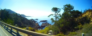
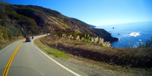
A buddy and I took a 5 day, 1700+ mile trip to California to ride the Pacific Coast Highway (PCH) and explore some other mountain areas in southern California. Here are the maps for those five days if you are interested:
| Miles | Day | Summary |
| 477 | Day 1 | Phoenix to Santa Monica, then PCH to Ventura |
| 254 | Day 2 | Ventura to San Luis Obispo (SLO), Cayucos, Morro Bay, Montana de Oro, SLO |
| 417 | Day 3 | SLO to Monterey, then back down coast to Ventura |
| 195 | Day 4 | Ventura, Mulholland Highway, Big Bear vi CA-18 |
| 444 | Day 5 | Big Bear to Idyllwild, Hemet, Indio, Phoenix |
Pacific Coast Highway (PCH)
 |
 |
 |
 |
What can I say about Highway 1, the Pacific Coast Highway, that hasn’t already been said more eloquently? It is a Bucket List ride, best ridden North to South so you are on the ocean (and scenic vista pullout) side.
Mulholland Highway
For those who enjoy a challenge, or simply like to people-watch, you should check out the stretch of Mulholland Highway (known locally as “The Snake”) between Topanga Canyon Road and Kanan Road (see Day 4 map for details). There are whole websites devoted to the spectacular crashes and amazing vehicles along this road. If you want to drive it, enter from Topanga. If you just want to people-watch, come in from Kanan. You must keep an eye on your rear-view mirrors, there are crazy drivers were illegally (over the double yellow line) passing us doing 70 MPH heading into a blind curve. A weekday may be better than a weekend to drive it, but the weekend is the best time to people-watch.
CA-18 Highway from San Bernardino to Big Bear
This is another great ride with lots of twisties. There are lots of places where the road is actually hanging off the side of the mountain on cantilevered supports. As you ride up from San Bernardino you can see the underside of the road above you. Big Bear is above 8000 ft in elevation, so there is a big change in temperature, and frequent storms. It was spectacular weather for us and well worth the trip.
Idyllwild
On Day 5 we took CA-38 (a very nice ride) from Big Bear down to Redlands, to Banning, where we turned off to ride through Idyllwild. A beautiful ride up from desert to forest with big vistas. We took a side trip to Hemet, a nice ride to a mediocre destination, then turned around and went back over the mountain and down to Indio. We had dinner and waited for sunset before making the 4 hour trip home.
Conclusions
Driving across the desert in July/August is HOT and not to be undertaken lightly. We have extensive hot-weather riding experience and special cooling gear, and it was still uncomfortably warm at times. We also moved this trip by 2 days to avoid storms in the Big Bear and Idyllwild destinations. I would recommend this ride for Spring and Fall rather than Summer if you have to cross much desert. If you are starting in the LA region, it’s merely uncomfortable.
I don’t normally give Google much credit, but I have to give them credit for keeping their map application up to date. We were going to ride CA-2, the Angeles Crest Highway (one of our favorites) but Google Maps wouldn’t let us cross a certain location no matter how many waypoints I used. It turns out that there had been a mudslide across the highway and it was closed.